
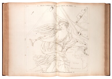
Edme Verniquet | Atlas général du plan de la ville de Paris. Paris, 1795, a ground-breaking large-scale map of Paris
Auction Closed
November 28, 01:19 PM GMT
Estimate
3,000 - 5,000 GBP
Lot Details
Description
Edme Verniquet
Atlas général du plan de la ville de Paris. Paris: chez l’auteur, an IV [1795]
FIRST EDITION, folio (520 x 365mm.) 72 DETAILED DOUBLE-PAGE MAPS OF PARIS ARRONDISSEMENTS engraved by P.T. Bartholomé and A.T. Mathieu, maps stamped on verso with Verniquet’s name, recent marbled calf gilt in period style, spine gilt in compartments with iris centrepiece without the title page and portrait of Verniquet, both often absent, a little browning and foxing at edges throughout, one plate with inconspicuous one-inch tear to lower corner (not affecting image), another plate with a seven-inch faint dampstain to one edge
The magnum opus of architect and cartographer Edme Verniquet (1727-1804), this is the first reliable topographical depiction of Paris. Taking four years to complete, it is the result of trigonometric surveys of the city involving some 50 engineers and draftsmen, all undertaken at Verniquet’s own expense. The atlas has served as the basis for all subsequent serious topographical representations of Paris. Verniquet had learned surveying from his father in Burgundy before moving to Paris to work with Buffon on the Jardin des Plantes, for which he designed the gazebo and the amphitheatre. The sections here are designed to fit together into one enormous map that would measure approximately 13 x 10 feet. The engravings include a decorative title cartouche supported by allegorical figures and surrounded by putti, as well as a comprehensive listing of streets and landmarks. The maps are arranged from east to west and north to south, beginning in Montmartre and ending in Montparnasse. Many of the streets and landmarks will be familiar to the modern user, although some have changed considerably since Baron Haussman’s 19th century urban renewal project.
REFERENCES: Millard I, 161; Phillips LeGear 8492; Tourneux II, 869