
Jefferys, Thomas | "One of the most authoritative and comprehensive atlases of America"
Auction Closed
April 26, 08:00 PM GMT
Estimate
70,000 - 100,000 USD
Lot Details
Description
Jefferys, Thomas
The American Atlas; or, A Geographical Description of the Whole Continent of America. London: Printed and Sold by R. Sayer and J. Bennett, 1775
Folio (543 x 350 mm). Letterpress title-page and index leaf, 22 engraved maps on 29 sheets, all save one printed on full or multiple sheets and folded, all maps partially handcolored in outline with additional coloring to one, all map sheets save one stencil-numbered, maps and text on guards; a few maps cut close or slightly cropped, some scattered soling and foxing, some neat, minor marginal restoration throughout, almost always outside plate-mark, a few short closed tears. Half calf antique over contemporary marbled boards; some rubbing to boards.
The scarce first edition of "One of the most authoritative and comprehensive atlases of America" (Ristow).
After the British victory in the Seven Years War, scientific surveys were undertaken that explored and mapped the interiors of the land east of the Mississippi River. The resulting maps, published separately by Jefferys as Geographer to the Prince of Wales (and subsequently to the King), were generally the best available for their respective regions. This atlas was published by Jefferys' successors Robert Sayer and John Bennett, and it provides a comprehensive record of the thirteen colonies during the Revolutionary War era and includes extensive reconnaissance mapping of French Canada, including Newfoundland. "As a major cartographic reference work it was, very likely, consulted by American, English, and French civilian administrators and military officers during the Revolution" (Ristow). The more common later editions do not include Lewis Evans's celebrated “Map of the Middle British Colonies in America.”
The American Atlas is comprised of the following maps:
1. Braddock Mead (alias John Green). “A Chart of North and South America, including the Atlantic and Pacific Oceans. …” Published 10 June 1775. 6 sheets joined as 3.
2. Imperial Academy of St. Petersburg. “The Russian Discoveries.” Published 2 March 1775. Full sheet.
3. Emanuel Bowen and John Gibson. “An Accurate Map of North America describing and distinguishing the British and Spanish Dominions. …” Published 2 July 1775. 4 sheets joined as 2.
4. Thomas Jefferys. “North America from the French of Mr. D’Anville.” Published 10 June 1775. Full sheet.
5. Samuel Dunn. “A Map of the British Empire in North America.” Published 10 January 1774. Half sheet.
6. Thomas Jefferys. “An Exact Chart of the River St. Laurence from Fort Frontenac to the Island of Anticosti.” Published 25 May 1775. 2 sheets joined as one.
7. Sayer and Bennett. “A Chart of the Gulf of St. Laurence. …” Published 25 March 1775. Full sheet.
8. “A Map of the Island of St. John in the Gulf of St. Laurence.” Published 6 April 1775. Full sheet.
9. James Cook and Michael Lane. “A General Chart of the Island of Newfoundland.” Published 10 May 1775. Full sheet.
10. “A Chart of the Banks of Newfoundland.” Published 25 March 1775. Full sheet.
11. Thomas Jefferys. “A New Map of Nova Scotia and Cape Breton Island with the adjacent parts of New England and Canada.” Published 15 June 1775. Full sheet.
12. Braddock Mead (alias John Green). “A Map of the Most Inhabited Part of New England.” With inset “Plan of the Town of Boston” and large figural cartouche of the Pilgrims landing at Plymouth Rock. Published 29 November 1774. 4 sheets joined as 2.
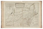
13. Samuel Holland. “The Provinces of New York and New Jersey; with part of Pensilvania and the Province of Quebec.” Published 16 June 1775. 2 sheets joined as one.
14. Lewis Evans. “A general Map of the Middle British Colonies in America.” Published 15 June 1775. Full sheet. With inset “Sketch of the Remaining Part of Ohio R. &c.”
15. William Scull. “A Map of Pennsylvania Exhibiting not only the Improved Parts of the Province but also its Extensive Frontiers.” Published 10 June 1775. 2 sheets as one.
16. Joshua Fry and Peter Jefferson. “A Map of the Most Inhabited Part of Virginia containing the whole Province of Maryland with Part of Pensilvania, New Jersey and North Carolina.” No date. 4 sheets joined as 2.
17. Henry Mouzon. “An Accurate Map of North and South Carolina with their Indian Frontiers.” Published 30 May 1775. 4 sheets joined as 2. With insets of “The Harbour of Port Royal” and “The Bar and Harbour of Charlestown.”
18. Thomas Jefferys. “The Coast of West Florida and Louisiana.” Published 20 February 1775. 2 sheets joined as one.
19. Lieut. Ross. “Course of the River Mississipi, from the Balise to Fort Chartres.” Published 1 June 1775. 2 sheets joined as one.
20. Thomas Jefferys. “The Bay of Honduras.” Published 20 February 1775. Full sheet.
21. J. B. B. D’Anville. “A Map of South America. …” Published 20 September 1775. 4 sheets joined as 2. With inset “Chart of Falkland’s Islands.”
22. Juan de la Cruz Cano y Olmedilla. “A Chart of the Straits of Magellan.” Published 1 July 1775. Full sheet.
REFERENCE:
Howes J81; Phillips 1165; Walter Ristow, "Bibliographical Note," in American Atlas [facsimile edition of 1776 ed.], 1973; Streeter 1:72
PROVENANCE:
Acquisition: William Reese — The Library of a Distinguished American Book Collector, Sotheby’s New York, June 4, 2013, lot 96
You May Also Like


