
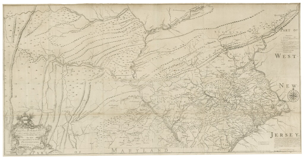
Nicholas Scull. Map of the improved Part of the Province of Pennsylvania. Philadelphia: 1759
Auction Closed
January 27, 09:56 PM GMT
Estimate
35,000 - 50,000 USD
Lot Details
Description
SCULL, NICHOLAS
MAP OF THE IMPROVED PART OF THE PROVINCE OF PENNSYLVANIA. PHILADELPHIA: ENGRAVED BY JAS. TURNER AND PRINTED BY JOHN DAVIS FOR THE AUTHOR; PUBLISHED & SOLD BY THE AUTHOR, NICHOLAS SCULL, 1 JANUARY 1759
Large copperplate engraved map on joined sheets (60 x 30 3/4 in.; 153 x 78 cm). with elaborate cartouche dedication to the Penn brothers. One faint spot, a superior example. Matted and framed.
This is the first large-scale map of Pennsylvania and one of the most important eighteenth-century maps engraved in what is now the United States (Streeter)
The mapmaker, Nicholas Scull (1700-1762), was Surveyor General from 1748 to 1761, successor to General Benjamin Eastburn, and was the first member of a North American family to engage in mapmaking as a business. A very attractive copy, in the first state, before the additions of text at Nelson’s Ferry and a road from Carlisle east to Pine Fort. Scarce.
LITERATURE:
Evans 8489; Streeter sale 2:965; Wheat & Brun 422