Property of a New York Collector
Lindbergh, Charles | Cartographic relics of Lindbergh's 1927 flight across the Atlantic
Lot Closed
July 20, 08:06 PM GMT
Estimate
15,000 - 20,000 USD
Lot Details
Description
Property of a New York Collector
Lindbergh, Charles
Four signed and annotated maps, including two portions of a map used in planning for his iconic 1927 trans-Atlantic flight
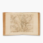
Comprising: Portion of a hydrographic map of the Western and Southern Atlantic Ocean, No. 955, 40th edition, May 1925 (but with small corrections printed through October 1926 and with date stamp from the Navy Hydrographic Office, Navy Department, 29 January 1927), trimmed to trapezoidal shape (890 x 492 mm at greatest dimensions), inscribed and initialed lower left margin, "Unused portion of chart for New York-Paris flight, 1927 C.A.L."
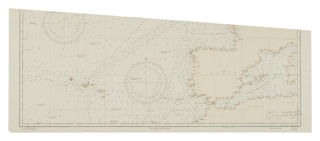
Portion of a hydrographic map of the Middle and Eastern Region of Atlantic Ocean, No. 956, 31st edition, March 1926 (but with small corrections printed through September 1926 and with date stamp from the Navy Hydrographic Office, Navy Department, 29 January 1927), trimmed to trapezoidal shape (1090 x 452 mm at greatest dimensions), inscribed and initialed lower right, "Unused portion of chart for New York-Paris flight—1927 C.A.L."
Rand McNally Standard Map of Wisconsin (707 x 530 mm), n.d., the recto printed in yellow with railroad lines shown, the verso printed in blue with main highways show, the recto signed ("Lindbergh") lower left in pencil and with autograph flight paths plotted in pencil, including Chicago to Minneapolis, 10-mile intervals ticked off and 50-mile intervals noted with numerals; quite creased, two short internal fold separation and one marginal chip.
Rand McNally New Official Railroad Map of the United States and Southern Canada (734 x 993 mm), n.d., signed ("Lindbergh") lower right; creased, several fold separations without loss.
Together 4 maps.
In 1919, a New York hotelier, Raymond Orteig, offered a prize of $25,000 to the first person to fly solo, non-stop, from New York City to Paris (or vice versa). Several individuals, lured by the prize and by the possibility of fame, either attempted the feat, or were planning to do so, before 20 May 1927. It was on this day that Charles Lindbergh, in the cockpit of the Spirit of St. Louis, flew from Roosevelt Airfield in Garden City, New York, to Le Bourget Airport in Paris.
Lindbergh’s plane was designed by Donald Hall and built by Ryan Aeronautical Company in San Diego, California, but on his vision of what would work: a one-engine plane with one cockpit and one set of wings. All of these modifications allowed Lindbergh to carry more fuel. Before attempting the trans-Atlantic flight, Lindbergh had to fly the Spirit of St. Louis from San Diego to New York. On 7 March 1927, according to biographer A. Scott Berg, Lindbergh flew to Los Angeles and visited a map store, purchasing "every chart he could imagine necessary for his Atlantic crossing—Mercator’s projections, a gnomonic projection, a time-zone chart of the world, a chart of magnetic variation, and even a few maps showing prevailing winds over the Atlantic during the spring months." For the trip to New York, he purchased "the trusty guides he had always used, Rand McNally railroad maps available in drugstores for fifty cents per state" (pp. 101–102).
The two unused portions of the hydrographic maps included here may have been cut out in order to save weight and, so, fuel, although the savings could not have been very great.
PROVENANCE:
The Archives of the American Geographical Society (Christie's New York, 19 June 2007, lot 271)
You May Also Like