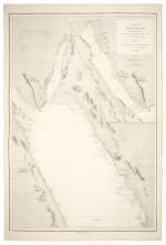
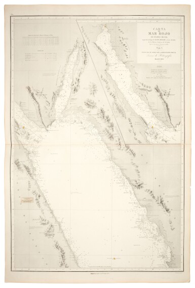
Red Sea | 4-sheet chart of the Red Sea, 1869
Lot Closed
May 13, 03:52 PM GMT
Estimate
1,000 - 1,500 GBP
Lot Details
Description
Red Sea--Elwon, Thomas, Robert Moresby [and Felix Jones]
Carta del Mar Rojo en cuarto hojas. Madrid: publicada de orden del Almirantazgo por la Seccion de Hidrografia, 1869
4 large lithographed folding mapsheets, 990 x 660mm., stretching from Suez in the north to Perim Island in the straits between Djibouti and Yemen in the south, 6 lighthouses marked in red with yellow surround, blindstamps of the Direccion de Hidrografia, printed paper correction overslip on western edge of first sheet
A rare chart of the Red Sea published in the same year as the opening of the Suez Canal, based on the surveys of Thomas Elwon and Robert Moresby, and the cartography of Felix Jones.
You May Also Like


