Travel, Atlases, Maps and Natural History
Travel, Atlases, Maps and Natural History
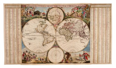
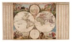
Carel Allard | World map, c.1683
Lot Closed
May 13, 01:39 PM GMT
Estimate
8,000 - 10,000 GBP
Lot Details
Description
Carel Allard
Novissima totius orbis tabula. Amsterdam, c.1683
500 x 900mm., engraved map on two sheets joined, with additional letterpress side panels pasted on, contemporary hand colour, a few marginal repairs
RARE. A FINE SEPARATELY-ISSUED, SEVENTEENTH-CENTURY DOUBLE-HEMISPHERE WORLD MAP, with two further spheres in the cusps showing the two poles. The four corners contain vignettes of the seasons, each with references to the elements and the zodiac. The side panels contain an extensive gazetteer, with a lettered key relating to longitude and latitude.
Carel Allard (1648-c.1706) did not issue an atlas until 1696 by which time this map had been replaced.
LITERATURE:
Shirley 517 (side panels not mentioned)