A collection of three Atlases: D'Anville, 1785; Levasseur, 1849; Stieler, c.1880
Lot Closed
November 17, 04:57 PM GMT
Estimate
500 - 800 GBP
Lot Details
Description
D'Anville, Levasseur, and Stieler
A collection of three Atlases, comprising:
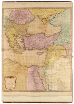
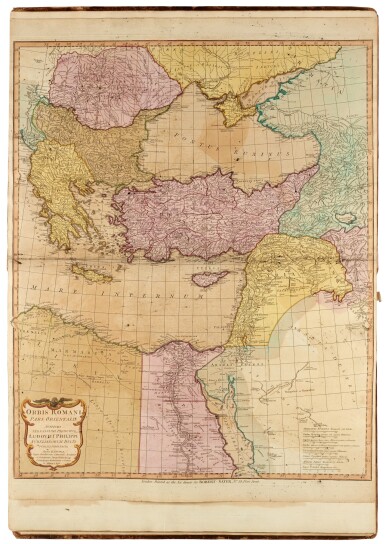
i) Jean Baptiste Bourgignon D'Anville. A Complete Body of Ancient Geography. London: R. Sayer and J. Bennett, 1785, folio (558 x 392mm.), 13 hand-coloured double page maps, rebacked in mid-brown morocco with original gilt-edged morocco boards, small tear to bottom of title-page, closed tear to bottom of 'orbus veteris notis' map, some marginal stains, light browning and offsetting to maps, hinges cracked, running to boards, and wear to extremities
ii) Victor Levasseur. Atlas National... de la France. Paris: Amable Combette, 1849, folio (528 x 357mm.), engraved throughout with frontispiece, statistical table, and 100 hand-coloured maps (86 France, the rest French Foreign Dominions and Continents), contemporary half morocco, raised bands, gilt titling to front board, marbled endpapers, spotting and browning, some maps partially detached, front free endpaper partially detached and slightly torn, joints cracked and wear to extremities
iii) Adolf Stieler. Hand Atlas: über alle Theile der Erde und über das Weltgebäude. Gotha: Justus Perthes, circa. 1880, folio (379 x 245mm.), 90 hand-coloured maps mounted on guards, contemporary half morocco gilt, ['in ardua Henry Charles Hoare' bookplate], some maps with slight browning along centre fold, hinges cracked, spine lightly bleached, rubbing to extremities


