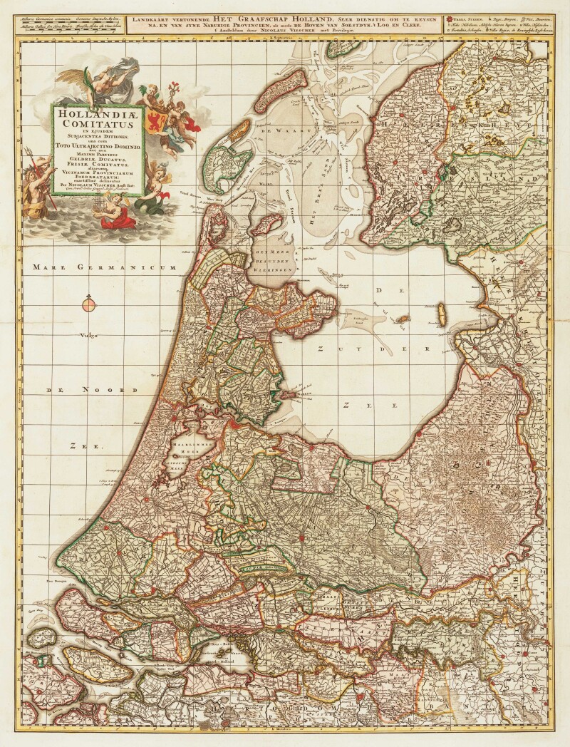
Nicolas Jansz Visscher
Map Of Holland
Circa 1690
Complimentary Shipping
Price:
International shipping available
Customs duties and taxes may apply.
Ships from: London, United Kingdom
Taxes not included
VAT and other taxes are not reflected in the listed pricing. Read more
Authenticity guaranteed
We guarantee the authenticity of this item.
Details

Description
A large and decorative 17th century map of Holland.
- Nicolas Jansz Visscher (Dutch).
- Hollandiæ Comitatus in Ejusdem Subjacentes Ditiones; una cum Toto Ultrajectino Dominio...
- Amsterdam, circa 1690.
- Original color.
- Two sheets conjoined.
- Unframed.
A detailed map of Holland, a province in the west of the Netherlands. The elaborate title cartouche celebrates the region's maritime accomplishments.
Condition Report
 Good
GoodMinor signs of age and wear.
Repaired tear at fold.
Product is used.
Dimensions
Language
Subject
Conditions of Business
Please note that the cancellation right for EU/UK purchasers applies to this item. Please read Condition 19 of the Buy Now Marketplace Conditions of Business for buyers for more information. Read more here.