Jan Jansson
English Map of Northern and Eastern Russia
Jan Jansson van Waesbergen, Moses Pitt & Stephan Swert
Circa 1680
Complimentary Shipping
Price:
International shipping available
Customs duties and taxes may apply.
Ships from: London, United Kingdom
Taxes not included
VAT and other taxes are not reflected in the listed pricing. Read more
Authenticity guaranteed
We guarantee the authenticity of this item.
Details

Description
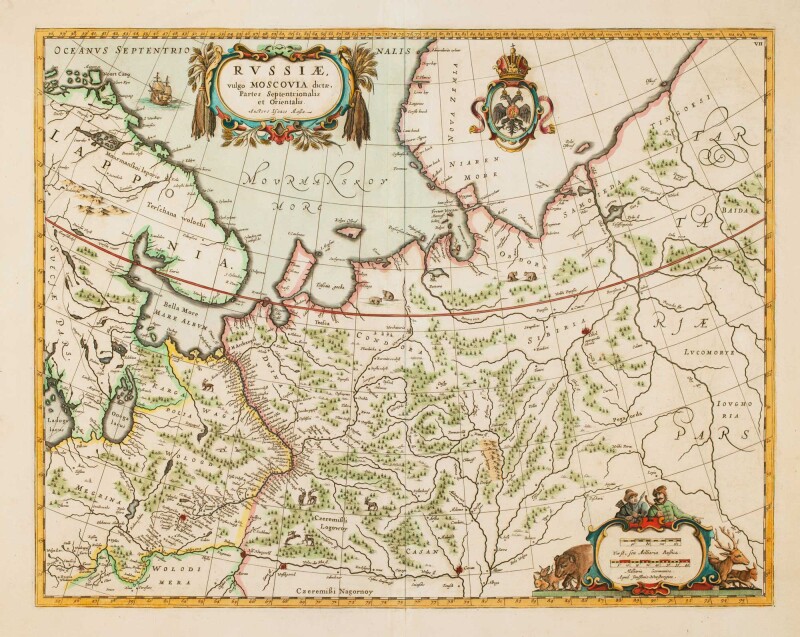
A map of Northern Russia, Lapland and the partial outline of Novaya Zemlya after Isaac Massa.
- Jan Jansson (Dutch).
- Russiæ, vulgo Moscovia dictæ, Partes Septentrionalis et Orientalis. Auctore Isaaco Massa.
- Oxford: Jan Jansson van Waesbergen, Moses Pitt & Stephan Swert, c.1680.
- Unframed.
Originally published by Jan Jansson in 1641, after his death the plates passed to his son-in-law, Jan Jansson van Waesbergen. He went into partnership with two English publishers, Pitt and Swert, to produce a twelve-volume "English Atlas" to compete with Blaeu's. Between 1680 and 1683, four volumes of the atlas and the text for the fifth were printed in Oxford, but the mounting costs were too much. Production ceased and for a time Pitt was locked up in the Fleet Prison for debt, making this state of the map quite uncommon. The differences are van Waesbergen's name as publisher and a grid engraved over the map.
Condition Report
 Very Good
Minor signs of age and wear.
Product is used.
Dimensions
Language
Subject
Conditions of Business
Please note that the cancellation right for EU/UK purchasers applies to this item. Please read Condition 19 of the Buy Now Marketplace Conditions of Business for buyers for more information. Read more here.