Francesco Salamanca
Italian Map of Greece | First State
Circa 1558
Complimentary Shipping
Price:
International shipping available
Customs duties and taxes may apply.
Ships from: London, United Kingdom
Taxes not included
VAT and other taxes are not reflected in the listed pricing. Read more
Authenticity guaranteed
We guarantee the authenticity of this item.
Details

Description
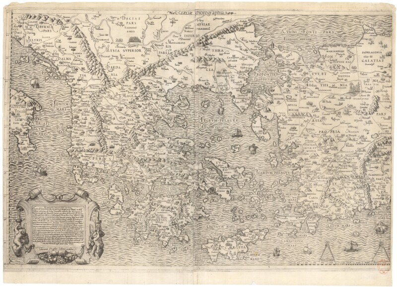
A very important map of Greece and western Turkey, compiled by Salamanca from Nikolaos Sophianos's landmark eight-sheet map of Greece of 1540, the most geographically accurate map of the region yet produced.
- Francesco Salamanca (Italian).
- Graeciae chorographia.
- Rome: circa 1558.
- This work is presented unframed.
This is the earliest available version, as the original has been lost and a woodcut version published in Basel in 1544 and 1545 are known by single complete examples of each.
Francesco Salamanca worked with his father Antonio Salamanca, who worked in partnership with Antonio Lafreri from 1553 until his death in 1562.
Francesco continued to work with Lafreri until the following year. This map seems to have been retained by Lafreri as the second state was issued by his successor, Claudio Duchetti.
Condition Report
 Very Good
Narrow lateral margins.
Unidentified ink library stamp to lower right.
Product is used.
Dimensions
Language
Subject
Conditions of Business
Please note that the cancellation right for EU/UK purchasers applies to this item. Please read Condition 19 of the Buy Now Marketplace Conditions of Business for buyers for more information. Read more here.