Eberhard Werner Happel
German Maps of the Western and Eastern Hemispheres
1684
Complimentary Shipping
Price:
International shipping available
Customs duties and taxes may apply.
Ships from: London, United Kingdom
Taxes not included
VAT and other taxes are not reflected in the listed pricing. Read more
Authenticity guaranteed
We guarantee the authenticity of this item.
Details

Description
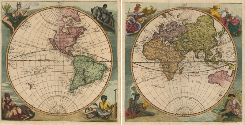
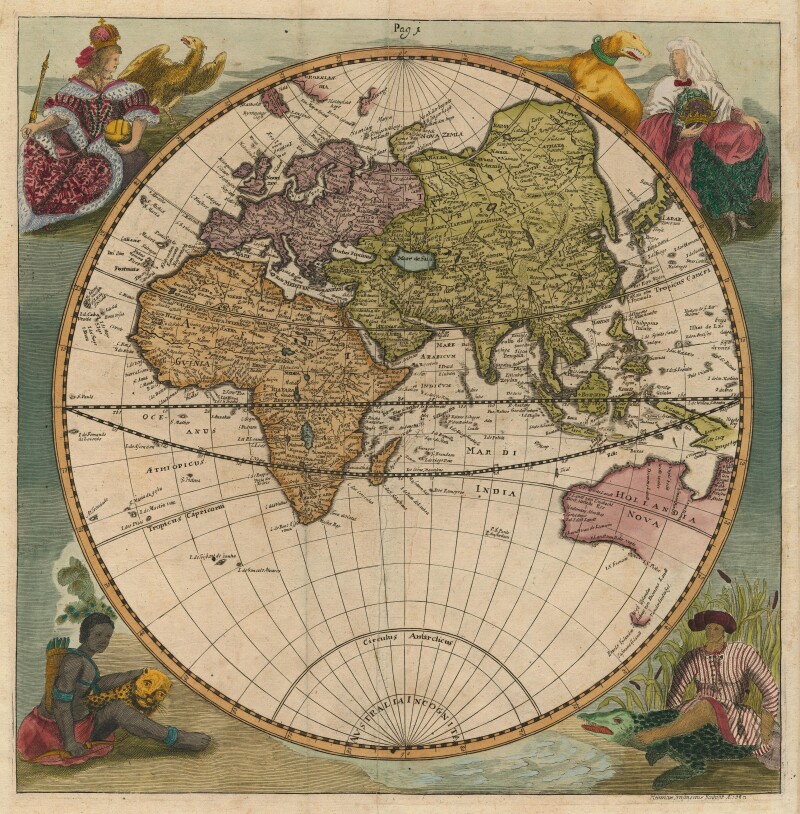
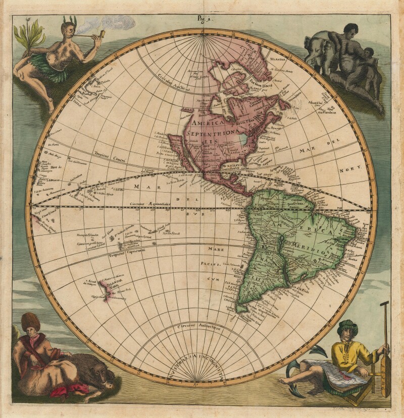
German maps of the western and eastern hemispheres by Eberhard Werner Happel.
- Sold as a set of 2.
- Eberhard Werner Happel (German).
- Untitled pair of Eastern and Western hemispheres.
- Ulm, 1684.
- Two plates.
- Each is presented unframed.
Untitled pair of Eastern and Western hemispheres.
A decorative pair of maps of the world in two separate hemispheres, both with allegorical figures representing the Four Continents in the corners.
In the Western Hemisphere California is an island; a huge Great Lake is open-ended in the west; New Zealand is mapped according to Abel Tasman
In the Eastern Hemisphere, the Caspian Sea is wider than it is tall; the east coast of Australia is unmapped, pre-dating Cook's visit by three-quarters of a century.
Published in the Historia moderna Europae, an account of Europe's recent political history.
Condition Report
 Very Good
Later colored.
Product is used.
Dimensions
Subject
Conditions of Business
Please note that the cancellation right for EU/UK purchasers applies to this item. Please read Condition 19 of the Buy Now Marketplace Conditions of Business for buyers for more information. Read more here.